
Election Maps
Benton County Election Maps
Welcome to Benton County’s interactive election map. Explore these maps to gain up to date insights into the districts and precincts in Benton County. These maps are an essential component for ensuring integrity and accuracy in our elections. Our commitment to transparency ensures you have the necessary information for a fair and accessible democracy.
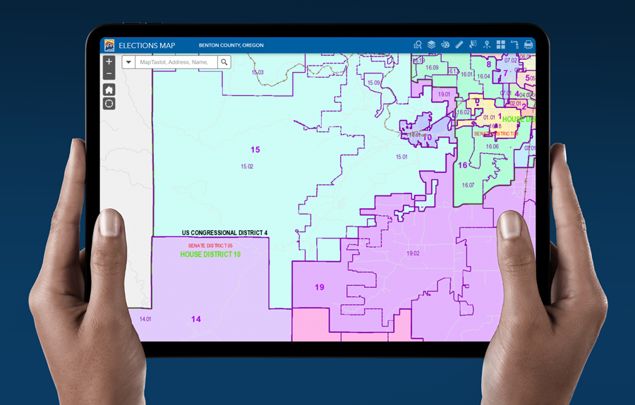
Benton County Interactive Election Map
PDF Versions of Benton County Election Maps
All information contained in the PDF elections maps links below are available via the interactive map above. If you are unable to find the information you are looking for, please use the interactive map above or contact the Benton County Records and Elections Department.